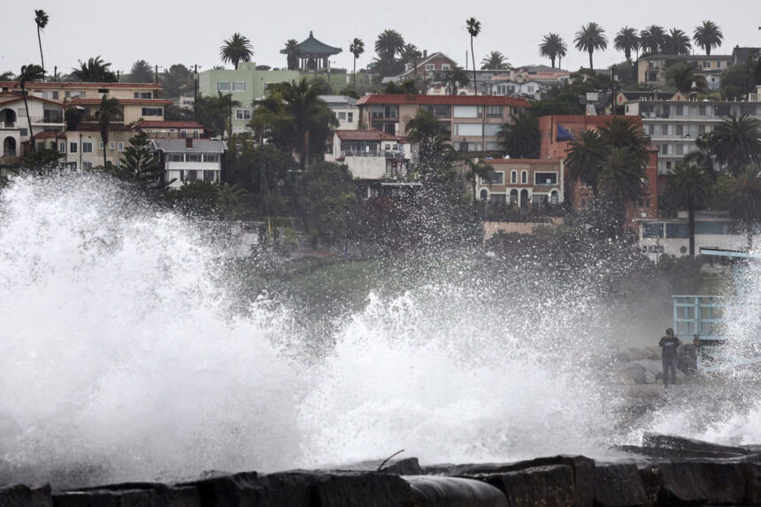
As California endures yet another onslaught of rain from an atmospheric river-fueled storm, the state faces heightened flood risks while Los Angeles surpasses its annual rainfall average.
The relentless storm, unleashing days of downpour, has wreaked havoc across the state, prompting the closure of Santa Barbara Airport, flash flooding in Los Angeles, and the toppling of century-old trees in Refugio State Beach.
Downtown Los Angeles has already accumulated a staggering 14.38 inches of rain since January 1, surpassing its average yearly rainfall of 14.26 inches in just two months.
Despite the deluge, there is a glimmer of relief as flood watches are set to expire for 23 million Californians by 10 a.m. PT, signaling improving conditions throughout the day.
While the storm system progresses eastward, it will bring scattered snow showers to mountainous regions and rain showers to parts of southern Nevada and Arizona. Fortunately, flash flooding is not anticipated in these areas.
Meanwhile, spring-like temperatures are set to soar to record levels across the Plains, Midwest, and Great Lakes, providing a stark contrast to the wintry conditions.
With meteorological spring on the horizon, temperatures are expected to spike 15-25 degrees above average, with potential record highs in the southern Plains.
However, the warm weather also poses a heightened fire risk in New Mexico, the southern Rockies, and parts of the Texas Panhandle, where gusty winds and low humidity create ideal conditions for wildfires.
As temperatures cool closer to seasonal norms over the weekend, the trend of warmer-than-average weather is expected to persist into early March, potentially leading to the warmest winter on record for the contiguous United States.
While winter remains the fastest-warming season nationwide, regions like the Northeast and the Great Lakes are experiencing accelerated warming, underscoring the broader impacts of climate change across the country. Stay tuned for further updates on the evolving weather patterns.


